2025年09月02日 16:50
Sendai Subway System (Sendai City Subway)
Sendai City Subway is a key subway system in the Tohoku region, connecting major areas of Sendai City and Sendai Airport.
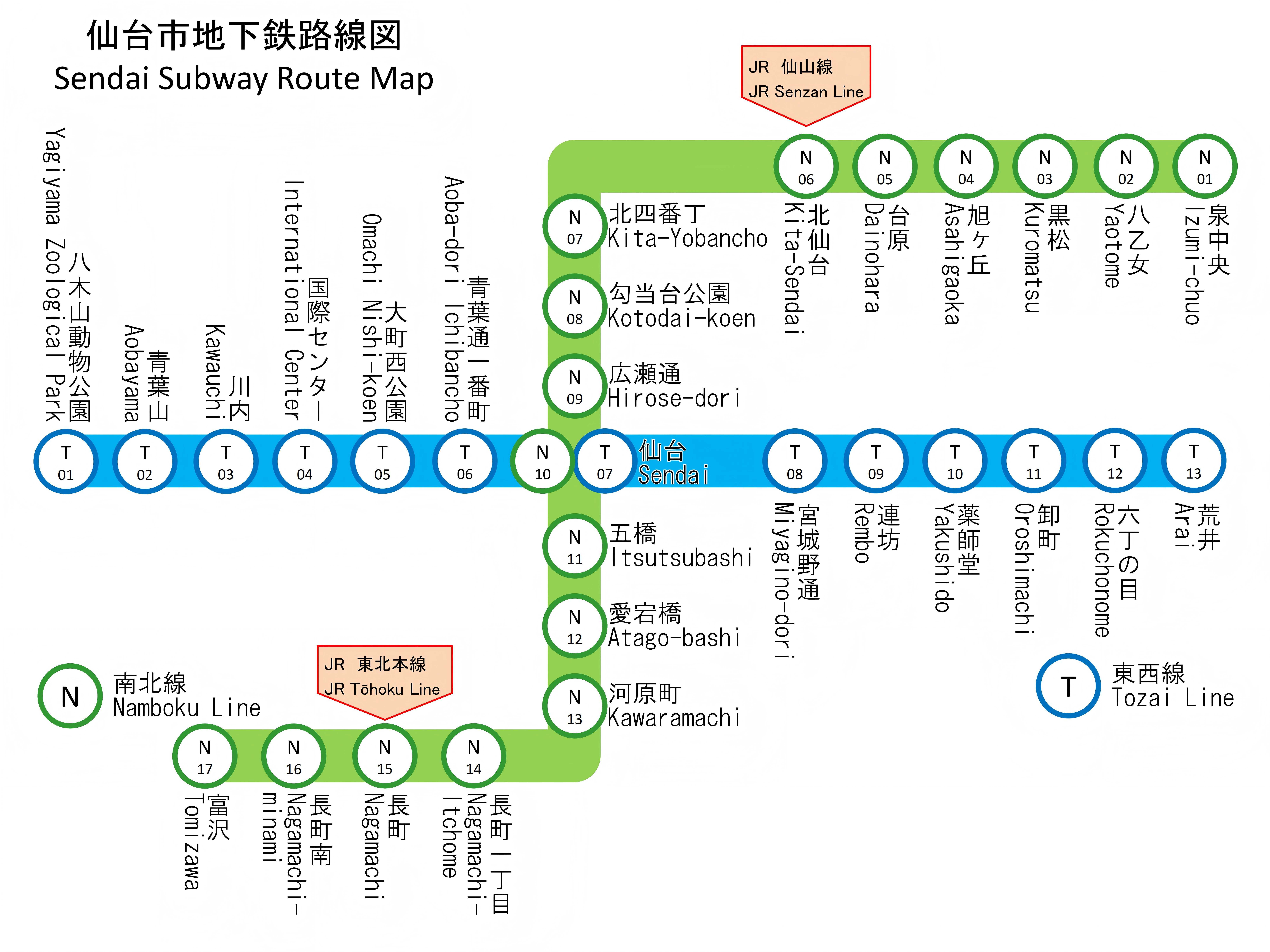
Sendai Subway Map
Sendai Subway Line Details
Overview of Subway Lines
| Line | Opening Year | Type | Length (km) | Number of Stations | Starting Station | Terminating Station | Daily Ridership |
|---|---|---|---|---|---|---|---|
| Namboku Line | 1987 | Subway | 14.8 | 17 | Izumi-Chūō | Tomizawa | 180,000 |
| Tōzai Line | 2015 | Subway | 13.9 | 13 | Yagiyama Dobutsuen | Arai | 65,000 |
Namboku Line Stations and Operating Hours
| Station Name | First Train | Last Train | Remarks |
|---|---|---|---|
| Izumi-Chūō | 5:30 AM | 12:00 AM | Northern Terminus |
| Yaotome | 5:32 AM | 11:58 PM | |
| Kuromatsu | 5:34 AM | 11:56 PM | |
| Asahigaoka | 5:36 AM | 11:54 PM | |
| Daihara | 5:38 AM | 11:52 PM | |
| Kita-Sendai | 5:40 AM | 11:50 PM | |
| Kita-Yonbanchō | 5:42 AM | 11:48 PM | |
| Kōdōdai Kōen | 5:44 AM | 11:46 PM | Sendai City Hall |
| Hirose-dōri | 5:46 AM | 11:44 PM | |
| Sendai | 5:48 AM | 11:42 PM | JR Sendai Station |
| Gohashi | 5:50 AM | 11:40 PM | |
| Atago-bashi | 5:52 AM | 11:38 PM | |
| Kawaramachi | 5:54 AM | 11:36 PM | |
| Nagamachi Ichibanchō | 5:56 AM | 11:34 PM | |
| Nagamachi | 5:58 AM | 11:32 PM | |
| Nagamachi-Minami | 6:00 AM | 11:30 PM | |
| Tomizawa | 6:02 AM | 11:28 PM | Southern Terminus |
Tōzai Line Stations and Operating Hours
| Station Name | First Train | Last Train | Remarks |
|---|---|---|---|
| Yagiyama Dobutsuen | 5:30 AM | 12:00 AM | Western Terminus |
| Aobayama | 5:33 AM | 11:57 PM | |
| Kawauchi | 5:36 AM | 11:54 PM | Tohoku University |
| Kokusai Center | 5:39 AM | 11:51 PM | |
| Ōmachi Nishi Kōen | 5:42 AM | 11:48 PM | |
| Aoba-dōri Ichibanchō | 5:45 AM | 11:45 PM | Shopping Street |
| Sendai | 5:48 AM | 11:42 PM | JR Sendai Station |
| Miyagino-dōri | 5:51 AM | 11:39 PM | |
| Tsuranuki | 5:54 AM | 11:36 PM | |
| Yakushidō | 5:57 AM | 11:33 PM | |
| Oroshimachi | 6:00 AM | 11:30 PM | |
| Rokuchōme | 6:03 AM | 11:27 PM | |
| Arai | 6:06 AM | 11:24 PM | Eastern Terminus |
Sendai Subway Operating Information
- Operating Hours:5:30 AM - 12:00 AM (may vary by line)
- Fare:¥200-320 for single journeys based on distance
- Payment Methods:IC cards (Suica, PASMO, ICOCA), paper tickets, one-day passes
- Official Website:
Sendai Subway Related Links
Sendai Subway Reference Links
评论
目前还没有评论。